Introduction
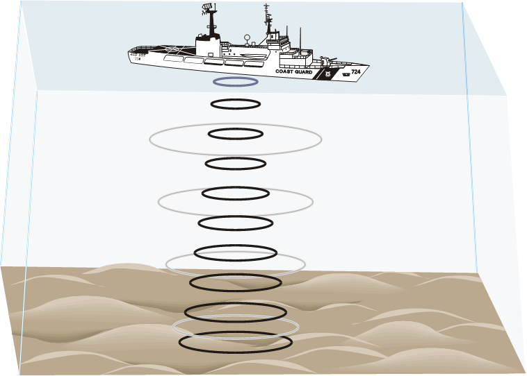
Oceanographers, marine geologists, and archeologists use echo sounders to investigate objects below the surfaces of bodies of water. An echo sounder incorporates a transducer that sends out and receives sound waves. A signal is sent out and bounces back from a submerged surface. Scientists use the speed of sound in water and the time it takes for the signal to bounce back to calculate the depth of the object. The deeper the object, the longer it takes for the sound to return. A map of the ocean floor is made by sending out a series of “pings” in a grid pattern and recording the depths. Echo sounders use different frequencies to map different things on the ocean floor.
Sonar, which is short for sound navigation ranging, is the name given to this echo sounding system. It was invented during World War I to detect submarines. In this activity, you will map objects on a simulated ocean floor using a motion detector that works very similarly to the sonar systems used to detect submarines.
Objectives
- Use a motion detector to measure distances.
- Map simulated ocean floors.
Sensors and Equipment
This experiment features the following sensors and equipment. Additional equipment may be required.
Ready to Experiment?
Ask an Expert
Get answers to your questions about how to teach this experiment with our support team.
- Call toll-free: 888-837-6437
- Chat with Us
- Email support@vernier.com
Purchase the Lab Book
This experiment is #19 of Earth Science with Vernier. The experiment in the book includes student instructions as well as instructor information for set up, helpful hints, and sample graphs and data.