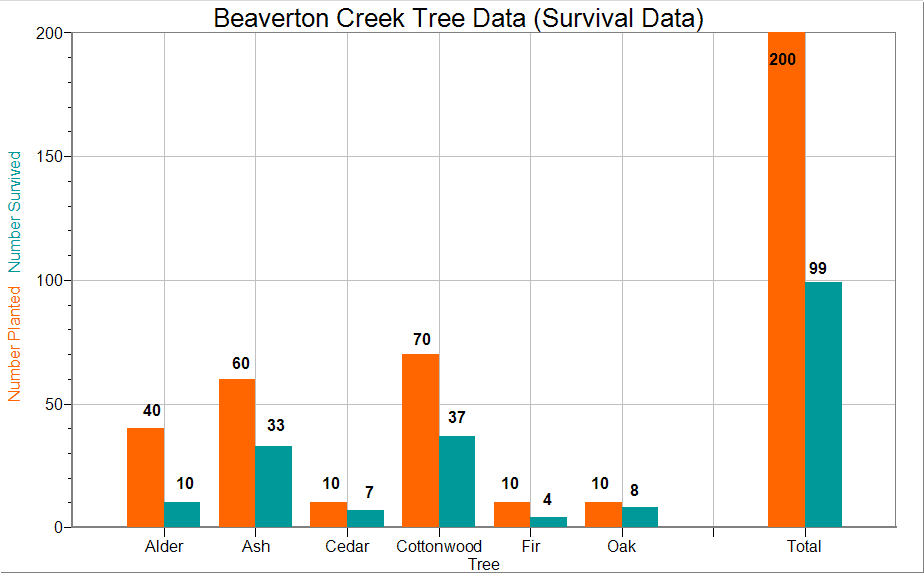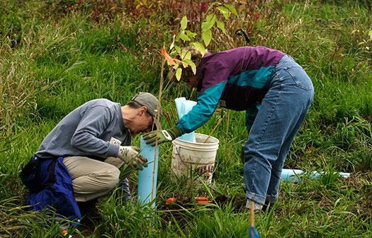
In late October 2005, employees from Vernier participated in a tree planting event in conjunction with the organization Friends of Trees. We planted 200 trees in the wetlands area surrounding nearby Beaverton Creek. Below is a table that shows the quantities of each type of tree that was planted, along with some general notes and estimated survival rates.
| Qty | Species | Common Name | Estimated Survival Rate | Notes |
|---|---|---|---|---|
| 40 | Alnus rubra | Red Alder | 50% | fast growing |
| 60 | Fraxinas latifolia | Oregon Ash | 80% | tough as nails |
| 70 | Populous trichocarpa | Cottonwood | 80% | fast growing |
| 10 | Quercus garryana | Oregon Oak | 60% | slow growing |
| 10 | Psuedotsuga mensiezii | Douglas Fir | 60% | medium growth |
| 10 | Thuja plicata | Western Red Cedar | 30-60% |
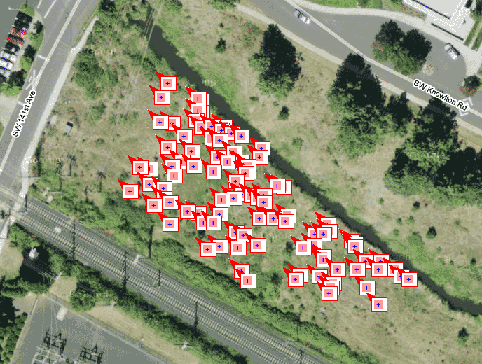
As part of the 2009 Earth Day activities, David Vernier and Jim McBride checked on the trees. They used a LabQuest and our Vernier GPS Sensor to note the position and type of each surviving tree. The map above shows the locations of the surviving trees. It was made by using Logger Pro to export these locations to a Googleâ„¢ map.
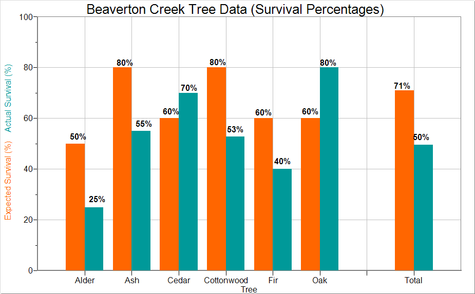
The first graph below compares the number that survived with the number planted. The second graph compares the survival percentages to the expected survival rate.