In March 2005, Olathe North HS (Olathe, KS) students Kevin Skov and Greg May, along with teacher Steve Obenhaus, took a trip to the southern reaches of Texas to explore Laguna Madre’s hypersaline characteristics. Laguna Madre, a large body of shallow water separating Padre Island from the South Texas mainland, is one of only a few hypersaline lagoons in the world.
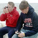
Using a Vernier Salinity Sensor, LabPro, and a laptop PC running Logger Pro software, they traveled south on the Intracoastal Waterway taking salinity readings from Corpus Christi Bay to Baffin Bay. For comparison, they also measured the salinity in several locations on the Gulf of Mexico.
Latitude and longitude data were collected with a handheld GPS unit and were recorded in Logger Pro for each collection site. The data were saved using Logger Pro‘s “Export in GIS format” feature.
Upon returning home, the data were brought into ArcGIS software to produce the map shown here. The results followed the expected trend of increased salinity from Corpus Christi Bay to Baffin Bay. When mapped, the north to south transition from hyposaline to hypersaline conditions was clearly visible.
Thanks to Steve Obenhaus and his students for the map and photo.