By Robyn Johnson, Vernier Software & Technology

By its name alone, LabQuest seems destined for adventure. When I decided to go on a National Geographic Expedition to Antarctica in January, there was no doubt in my mind that I would be taking mine with me. Sailing from Ushuaia, Argentina, we spent almost two days crossing the infamous Drake Passage.
For eight days, we sailed around the Antarctic Peninsula, seeing incredible scenery, many seals, whales, and literally hundreds of thousands of penguins. I was a curiosity to the group of 140 travelers as well, as each day I pulled out my LabQuest and sensors to take my readings. They thought it was very cool, and many would come back each day to see what the readings were.
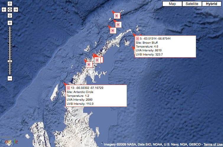
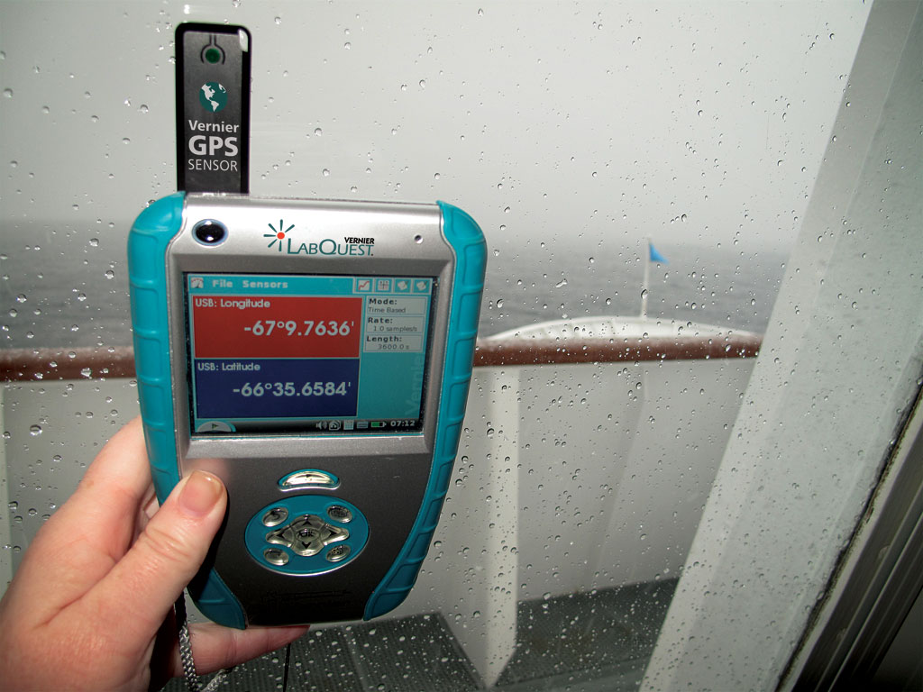
Using the Vernier GPS Sensor connected directly to the LabQuest, I collected location data, along with temperature and UV light intensity data. Transferring the information to Logger Pro on my computer back in the cabin, I used the Export as Google Map feature to create the map you see to the right. This shows all the landings we made, with two of the markers expanded to show details of the data collected at that location.
Brown Bluff was our first stop on the Antarctic mainland. The annotation shows my latitude and longitude in units of decimal degrees. LabQuest can also display units of degrees and minutes, or even in UTM coordinates. Notice they are both negative values, indicating that I am in the Southern Hemisphere and in the Western Hemisphere. The temperature was a balmy 4.6°C (it was summer there, after all), and the UVA and UVB light intensity readings, in units of mW/m2, were the highest we have ever recorded with our sensors.
The other open annotation is the point at which we crossed the Antarctic Circle. The temperature was down to 1.2°C, but the UV readings were lower than locations farther north. Why would that be? It was a very cloudy day, blocking some, but not all, of the UV radiation.
The photo below shows my LabQuest with the new Vernier GPS Sensor on the ship’s bridge just after crossing the Antarctic Circle. A latitude of −66.59133° is surely the farthest south a LabQuest has been so far!